Monday, July 27, 2009

My other passion

I love flying just as much as I love biking.

It's always an internal conflict on the weekends...Do I go flying or do I go biking? The videos below show what kind of fun we have in the mountains with our RC gliders. Just a bunch of boys playing with their toys! Karl took the first video up on McClellan Mtn near where I'll be riding next Saturday. NO MOTOR on this RC plane, just using the wind like a wave and the backside of the mountain like an eddy behind a rock in a river (dynamic soaring). The whole group of Front Range RC slope pilots are a blast to hang out with. Sometimes we do combat and try to knock each other out of the sky, sometimes we do fast dynamic soaring circles going for personal speed records, and sometimes we just get mezmerized by the fluidity and grace of riding the wind. You can bet that while I'm grinding up Argentine Pass, I'll be thinking about the wind conditions on McClellan.


(Video from Karl Decker)

Here's another video of Nick reaching unreal speeds with his glider (from Ian)

The sounds of DSing at Jones Pass (from Ian)

Combat on Lookout Mtn (Zion) (from Ian)

Monday, July 20, 2009

West Empire Loop

July 18, 2009

Solitude or companionship. Both can bring joy to our lives. In the past, I've done the majority of my big rides solo, but this time I had an opportunity to ride it with other like-minded mountain bike junkies. I relished their company.

Although the physical path my be the same, a solo adventure creates vastly different memories from a journey with friends. Teamwork and comraderie don't exist on solo adventures. These aspects of riding were missing from many of my previous adventures.

I rode out of Empire by myself at 7am. I rode Hwy 40 and Jones Pass Rd with the conviction that I could make it this week without stopping. Besides having to check my front quick release near Empire, I was able to accomplish that goal. I made it to the top of Jones in 2:30 with less than a minute of stop time (yeah!)
Jones Pass-last bit of snow blocking the road
Jones Pass cornice

Just as I was about to climb up the last pitch of snow to crest the cornice, I saw three bikers coming up the road. I thought it may be the group of guys I'd been emailing over the past week about doing this loop together (MGE, Bad Andy, and Lubes). I figured I somehow got the start time wrong. I was elated to see them because the thought of riding Bard Ck solo just gives me the chills. There's something about that trail that just freaks me out. I don't feel comfortable riding it solo (but I would if I couldn't find others to ride it with me).
Lubes climbing Jones cornice
Bad Andy! climbing Jones cornice
MGE climbing Jones cornice
Jones Pass July 18, 2009
Once on top of Jones Pass, the fun began. I was able to ride more of it this time than last week.
CDT south of Jones

The wind was pretty strong out of the WNW and every time we hit that aspect along the continental divide, trying to stay on the trail got harder. It would have been a great day to fly my RC glider atop that ridge. A few of my flying buddies were headed over to McClellan Mtn that day and they asked if I was coming too, but biking has been at the top of my list the last few weeks. Additionally, other flying buddies were asking if I was going to compete in the LoveAir precision aerobatics competition that weekend too...but biking takes top billing this time of year.
View of Greys/Torreys from CDT
Coming down off the divide into Woods Gulch was as fun as ever...except for my flat...It was a good thing that I went back for my tool bag after initially leaving it behind when I left the house this morning.
CDT downhill
Before we hit Herman Gulch, we spotted another rider coming down the trail. It turns out that it was someone else from MTBR. We hit the crowded Herman Gulch trail as a group to try to minimize conflict on the trail. All of the hikers were courteous as we passed them on the way down. Lubes was right beside me when he inconceivably propelled his bike on top of a log bridge but for some reason he couldn't ride it out and had to abandon the attempt. He ended up breaking his front brake lever so I thought his day was over...But I was wrong...He was able to rig it and ride the rest of the day.

Sidenote: I took my cousins from Virginia up Herman Gulch about a month ago (that was my first time up Herman Gulch) and they really enjoyed it. Afterwards, he couldn't remember the name of the trail and kept calling it 'Homer's Gap'. It made me laugh and for some reason, the name just seems to fit.

We stopped and rested at the base of Homer's Gap before tackling the next uphill (Watrous Gulch). I was able to ride more than I expected up Watrous and when we reached the Bard Ck Trail, we stopped and filtered water before continuing to climb (now even steeper).

Bard Ck Trail
The Bard Ck Trail was more difficult this year compared to last year. I think it was because of all the miles we had already put in at altitude. In any case, I walked more this year than last year (but I didn't go over the bars at all on this ride). We made slow but steady progress as we contoured around the mountain. Everyone was feeling the miles of very difficult terrain by the time we turned the corner into the last basin before Bard Creek. As soon as we hit a defined trail in Bard Ck drainage, Lubes took the lead with determination. Within what seemed like minutes, we were back at the car.
West Empire Deathmarch Jul 18, 2009 (Google Earth)
West Empire Deathmarch Jul-18-2009

Overall Stats:
37 miles
10,000 ft of climbing
13:36 total time
4:43 stopped time
4.2 mph average speed
37 mph max speed

Tuesday, September 2, 2008

Bard Creek Trail

Bard Creek Trail is EPIC!!!

After last weekend’s adventure into a known area (Williams Fork Loop), I was having a hard time deciding what trail to ride during the Labor Day weekend. I had initially thought of going up to Spearfish, SD to ride the Dakota 5-0 but the cost of gas and the time spent in the car for a single day of riding just didn’t seem like a worthy tradeoff. With the good days to spend above treeline waning, Monarch Crest came to mind but I really didn’t want to drive that far to find out everyone else in Colorado had the same idea. I started looking closer to home for some unknown trail that meandered around 12,000 ft and could be turned into a loop. There’s something about loops that make them so much more appealing to me than a simple out-n-back. Maybe it’s the fact that you’ve got to commit to a loop at some point in the ride…I guess that would be the ‘point of no return’, huh?

I had talked with a co-worker about the Bard Creek Trail that connects Herman Gulch (along I-70 near Loveland Pass) with Empire, CO (on Hwy 40 going to Berthoud Pass). He is a trail runner and always had good things to say about this trail. His only hesitation is that you never really get away from the noise of traffic down below on I-70. The advantage of this trail is how close it is to home, however, and that out weighed the disadvantages. So I started looking at it on the Forest Service maps and came up with a loop out of Georgetown. Initially, I wanted to complete the loop counter-clockwise which would have me climbing up the jeep road and descending down pavement…I’m glad I decided to switch it around and do the climb up the pavement because the descent down the rocky jeep road was arguably the best part of the ride.

Last week, I put out an open invitation to ride Williams Fork Loop and ended up with a very nice, very capable, and intelligent riding partner. I’d been burned by putting out open invitations before so I was a bit hesitant this last time. But with last week’s ride going so well, I thought I’d try it again for the Bard Creek Loop…I got one taker.

We met at the vistor’s center in Georgetown and headed up the road to Bakerville. We chatted as we climbed and I found out that he had never ridden above treeline before. If I had known that ahead of time, we probably would’ve ridden a different trail—likely Monarch Crest or Kenosha Pass—something that I would’ve known to be more rideable and enjoyable for a first ride above treeline. But we were committed. We continued to chat up the Bakerville-Loveland Trail and as I spotted the Herman Gulch I-70 exit through the trees, I thought we had gone too far and missed our turn so we bushwacked through the willows and walked through the creek.
Clear Creek Crossing
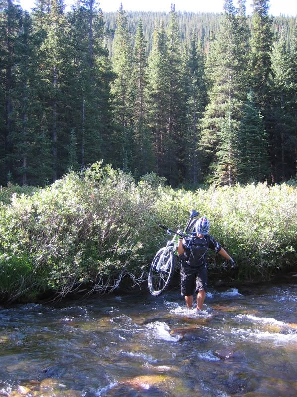
We still didn’t find the trail on the other side so we climbed up to the shoulder of the interstate and rode down the entrance ramp to the exit. At the exit, I realized that we hadn’t gone far enough and if we would’ve ridden up the trail a few hundred yards, we would’ve had a bridge to cross on…Oh well, next time. There were already a good number of cars in the parking lot at the trailhead but I knew that once we got off the Herman Gulch trail, we’d see little to no people. We started the steep climb up Watrous Gulch.
Watrous Climb
As soon as the trail mellowed out, we crossed a small creek and found our turn off.
Watrous Creek
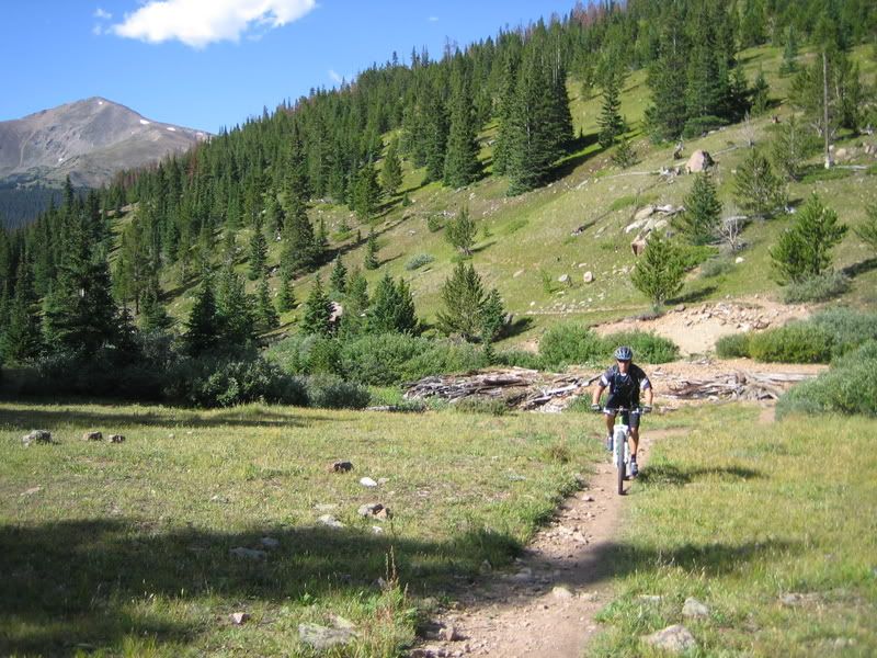
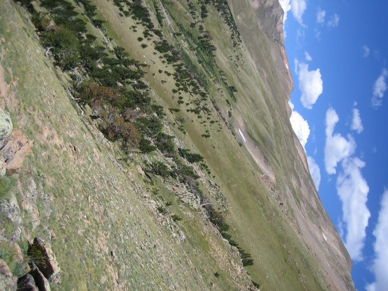
It didn’t take long until the trail had a good deal of exposure. I guess I’ve somewhat calloused myself towards exposed trails more than I thought over the years. I forget how intimidating trails that have ‘no-fall-zones’ can be to the uninitiated. Although my riding partner this weekend was new to this, he did a good job with learning what he felt comfortable riding and what not to try.
Parnassus Face
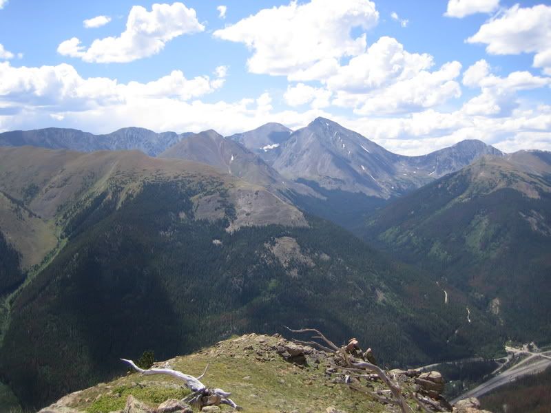
The trail traverses a couple of 13,000ft peaks along treeline, descending, climbing, and wrapping into little hidden drainages. There are a number of cool bristlecone pines along the route.
Bristlecone Pine
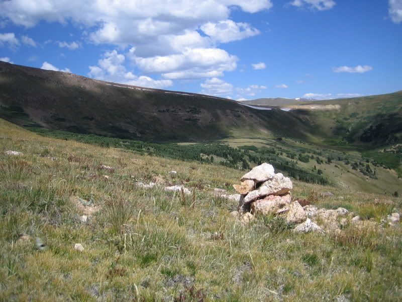
And there are times when the trail just completely disappears…only cairns to follow…
Can you see the trail?
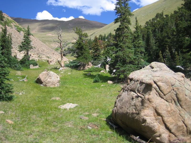
We continued to traverse across the mountain to a good vantage point that had a large cairn on it. There was quite a bit of hike-a-bike involved and route finding. I stopped and waited for Shane at the cairn and took a panorama of the vista.
The narrow traverse
Panorama 2
Steep Face
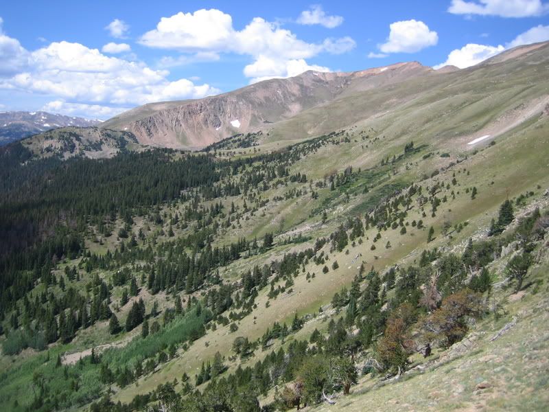
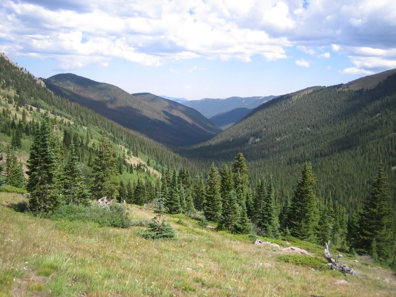
Then we continued on into this hidden basin. The saddle at the far end of the basin was the top of the downhill segment of our ride.
The Bark Ck Saddle
We encountered our first person for the day near the top of the saddle. He looked like a hunter out scouting. We continued on and Shane refilled his camelback at a cascading creek. I found out at the same time that my iodine tablets had become powder after living in my first aid kit for over a year. We treated his water by estimating the dosage, but I don’t think he drank from it the rest of the voyage.
Bard Ck Drainage
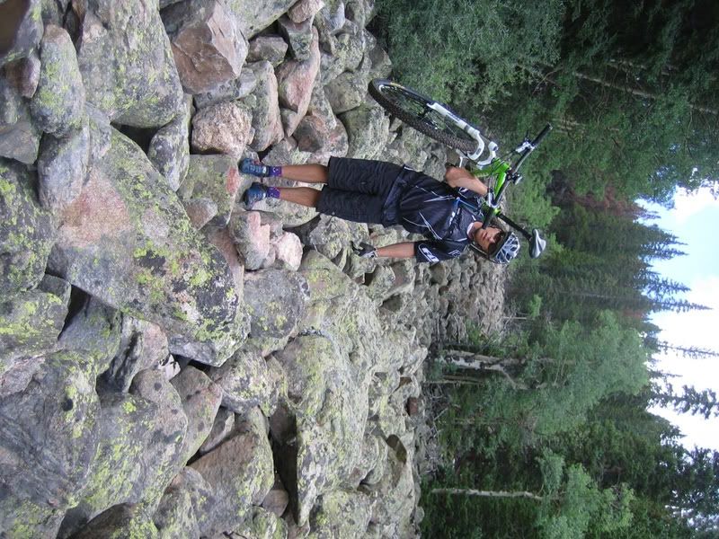
The trail continued to get better and better as we descended. There were still a few obstacles that had to be crossed by carrying the bike, however.
Bard ck Rock Garden
We finally hit the trail head, and the jeep road dropping back to Empire Pass was some of the most fun I’ve had in a long time…Loose rocks, big water bars, fast flowing sections…Then we hit the last bit of singletrack down Empire Pass and we were back at the cars in about 7 hours.
Empire Pass

As a sidenote, I fell more times on this ride (all over the bars because of getting the front tire stuck in a hole) than I have all season. I knew when I could take risks and when I couldn’t so I didn’t have any nasty falls. The worst fall was in a mud hole when it ate my front tire first and then I smelled bad for the rest of the day.

Monday, August 25, 2008

Williams Fork Loop

Finally got a chance to ride the Williams Fork Loop!!!

A new friend and I were able to get this loop completed yesterday. We opted to drive over Jones Pass and start from the Bobtail Mine. This cuts out about 5,000 feet of climbing-half at the beginning and half at the end-and alleviates the fear of getting caught on the wrong side of the pass if a thunderstorm pops up.

The loop was roughly 33 miles, 4,400 ft of climbing and took us about 9 hrs. There was a lot of hike-a-bike (but that was expected) so the stats don’t tell the whole story…

We left the car just before 8am and the sun still hadn't hit the valley floor. The loop began with a VERY COLD creek crossing followed by a couple more while still in the shade. Brian did the first crossing while precariously stepping from rock to rock using his bike for balance, while I just decided I might as well start with cold, wet feet.
First creek crossing
It turned out that there was so much dew and frost on the vegetation that Brian’s feet were quickly soaked anyways. It didn’t take long before I didn’t have any feeling in my big toes. After all the creek crossings were done, we finally made it into the sun, stopped to eat and change socks, then started up the first climb. It’s almost all hike-a-bike to gain the ridge from the creek (~1,500 feet).
Bobtail Drainage
This trail gets so little use that it’s difficult to find at times. We saw no human tracks, only moose and elk for most of the day just to give you a sense of it’s usage.
I think this is the trail
Climb, Climb, Climb
The views to the east at Pettingale were spectacular during the climb.
Some okay trail on the climb
We took the obligatory photo next to the sign at the crest of the ridge.
Top of first climb
The first drop-in over the ridge was a little daunting…
That first steps a doozy
In spots, the only way to identify where the trail went was by the sporadically spaced cairns. It is fun but bumpy riding across the tundra.
Where'd the Trail go?
There were some incredible views and riding along the ridge but the riding goes through many ‘no-fall-zones’.
Tricky Trail
Steelman Drainage
Ridge Riding
There was quite a bit of riding from cairn to cairn along the ridge and it is slow going at times. I remember looking down at the GPS and seeing that it had taken us 3 hours to go 5 miles. Then we reached the drop into the west valley.
Drop into West Fork Drainage
West Fork Beaver Pond
There were at least four creek crossings and only one had a bridge. On the plus side, the trail is MUCH more defined in this valley than the first valley making the riding go much faster.
West Fork Broken Bridge
West Fork Bridge
West Fork Trail
We stopped and refilled our water at the campground where the two forks meet. It was odd to get to a deserted campground and refill at the hand-pump. Since this area was heavily infected with pine beetles, they had done a bunch of logging within the campground. We left the campground and headed for the boardwalk that crosses the swamp/marsh. We saw our first person of the day at this trailhead…Looked like he was going fishing. Then we found out that they had removed the center section of the boardwalk so we had to once again get our feet wet.
What happened to the boardwalk?
Then it was onto the ‘new to me’ Darling Creek trail. In the past adventures on the Williams Fork Loop, we had always crossed on the boardwalk and headed upstream on the South Fork trail. But this time, we headed downstream on the Darling Creek trail.
Beetle Kill
I had no idea what to expect, but I knew that the trail would lead us to the aquaduct road that I had ridden a few weeks prior. This area had been heavily hit with beetles so I was expecting a lot of downed timber. The trail started out really rocky and I was starting to think that this could have been a mistake. After less than a mile, we found out that we could’ve bypassed the boardwalk by starting up Darling Ck trail by the portal for the Henderson Tunnel. There were signs at the portal saying the trails (I presume both Darling Ck and South Fork) were closed for logging operations but we had no option other than heading up one of the two to get back to the car. I was expecting the worst from Darling Ck (since I had never been on it before) and was pleasantly surprised at how much was rideable. As soon as we got around the portal, it actually turned into a decent climbable trail.
Darling Ck
Once the trail crosses the creek and turns up a tributary, it was more hike-a-bike than riding but there were still a few sections worth attempting.
Darling Ck - Brian
Then it was a fast cruise down the aquaduct road.
Aquaduct
We saw only 2 people on the entire trip: one at the campground going fishing, and another on the aquaduct trail a couple of miles from the end. The second guy was stashing a bunch of coke cans in a creek and was pulling a Burley trailer loaded with a hunting camp. He asked if we were out there scouting (I think he was afraid that he’d have to share his hunting spot). Somehow, we avoided all the storms in the area.

Tuesday, August 5, 2008

Copper Triangle

No, I didn't ride the sanctioned Copper Triangle. In fact, I didn't even know it was going on until I pulled off I-70 at Copper only to see a cop sitting at the intersection and the outer parking lots COMPLETELY FULL!!! I asked a couple of guys working the parking lot what was going on and then I asked them about the trails and they replied, "Oh, you won't see anyone up there today." Although I didn't quite believe them, I was at least relieved to find out that there wasn't a race on the trails...But the CTR racers had been through here earlier in the week and it was because of watching the blue dots that I got the urge to ride what I call the off-road copper triangle (although it's really more of a rectangle than a triangle). Anyways, it had been since 2005 that I had ridden this route and on that trip I had my wife meet us at Camp Hale with food and water. I remember it being difficult for me at the time and I really needed the resupply of food from my wife. I remember we had a rough time climbing Resolution Creek Road in 2005 and we had lightning striking around us at the top that made us cower under some trees until the storm passed. I broke one of my wisdom teeth that day requiring me to get it pulled later the next week.

This trip was a solo endeavor with no support. Once I got out of the center of Copper and onto the trail, I was able to enjoy some solitude.
Copper Triangle - Start
Climbing to Guller Gulch was not as difficult as I remembered it being, plus it went by rather quickly. Although I took my MP3 player, I didn't turn it on at the start. I wanted to ride without it for a change but told myself that I could listen after I reached Searle Pass. Instead, I replayed portions of songs in my head...It's funny how you sometimes have complete control over what songs you replay, while at other times you have no control...Today I had control...
Copper Triangle - Guller Gulch
I stopped and talked with a few hikers coming down from spending the night at Jenny's Cabin. I also ran into a family that was thru-hiking the CT (they had planned on taking 7-weeks to finish). It wasn't too long and I was at Searle Pass. When I stopped I noticed an that one of the wings on my new Crank Bros eggbeater pedals was cracked through and twisted. No wonder it sometimes felt sloppy on the climb! Well, there was nothing I could do about it now so I didn't fret over it. I ate a Snickers Bar, refilled my water bottle with Gatorade, and talked with the local fauna.
Copper Triangle - A little friend
Then it was off to Kokomo Pass. I really love this section of trail above treeline. As I crossed the alpine tundra, I wondered if the tracks left in the few muddy sections were from the CTRers.
Copper Triangle - Kokomo Pass
The wildflowers coming down Kokomo Pass were really spectacular. This is such a fun descent!
Copper Triangle - Down Kokomo
When I got to the bottom, I went to shift gears only to have my chain get stuck between the 2nd and 3rd chain rings...Great...I thought I was going to be stuck in Camp Hale. I had lost 2 of the 4 chain ring bolts but luckily I was able to move them opposite each other so I could complete the ride. I also realized that the broken wing had fallen off and now the opposite one was cracked and ready to fall off! I continued on down the CT along the road and spooked a coyote who ran alongside the trail through the sagebrush at almost the same speed as me riding. It was cool to see him cruising along next to me for about 100 yards.

After leaving the CT, I cruised down the road and ate a few crackers/PB. It was a short ride to reach Resolution Peak Road. Then 2500ft up to the pass. I felt really good during the climb and only had to stop once or twice for a couple of seconds to refill my water bottle, grap some more crackers, and wait for jeeps or ATVs to pass.

It was like deja vu when I neared the top. Dark clouds started rolling in and then there was thunder just to the north. I had about 500 ft to get to the top so I stepped on it a little harder knowing I was starting to dig a hole but it would soon be over and I wouldn't have to wait out the storm. I quickly made it over the top (through a herd of sheep...but no sheep dog?) and started dropping into Wilder Gulch. It was packed with hikers which really slowed the descent and then I saw my first mountain bikers of the day less than a mile from the bike path.
Copper Triangle - Wilder Gulch
After I reached the bike path, the Copper Triangle riders were everywhere. I came around one of the first switchbacks to find an ambulance blocking the trail. I guess someone went down and they had him strapped on a backboard. I was really surprised at how slow alot of these riders were going. It seemed like I was passing them all. As I neared the village, the race volunteers were directing all the riders towards the center of the village--and I guess they all assumed I just lost my number so I was grouped in with the rest of the riders. It was interesting to finish off the ride by going through the start/finish line, having strangers clap and say good job to me even though they had no idea of where I went.
Copper Triangle - Finish Line!

Stats:
(I'll post them up later)

PS...
This was the first trip with the Ergon grips I got for my birthday and I really LOVED THEM!!!