Monday, July 28, 2008

Jones Pass

Headed up to Jones Pass again on Sunday. I really wanted to explore the aquaduct trails/roads on the west side that I didn't get a chance to visit last weekend when I was sidetracked on the CDT.

Quite a bit had melted since last weekend.
Jones Pass July 27, 2008
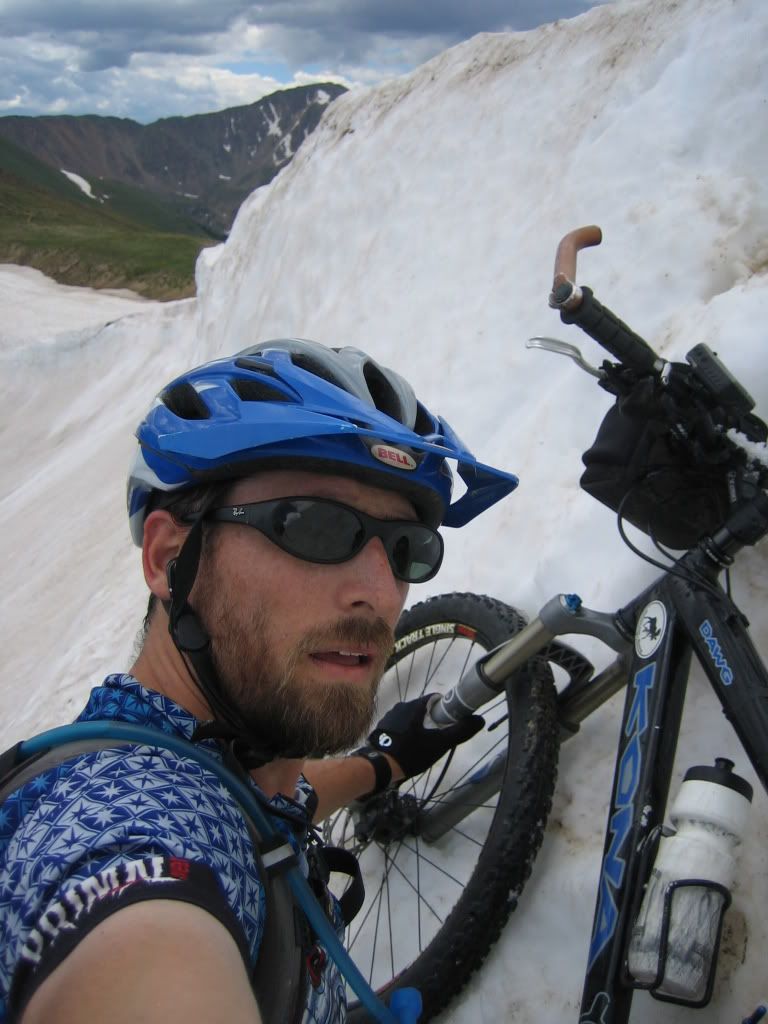
I took a more challenging line up and over the cornice this time. I really had to make sure that the bike was acting as a good anchor because the steepness of the snow was over 40-degrees and a slip would've resulted in a lot of pain.
Cresting the cornice
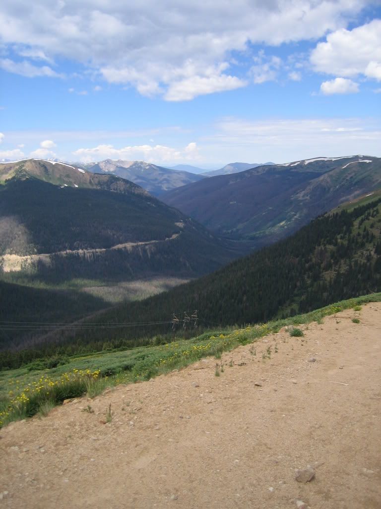
There were already clouds building and it was only 11am...I knew I was taking a risk by dropping down the west side of the pass and I've been stuck on this side before but what the heck, I'll take that chance. Here's the aquaduct trails/roads I was heading towards
Looking down from Jones Pass West
The first one was a mellow road to begin with
Aquaduct south
Then things got a little more techincal as I neared its end
Fun Aquaduct trail (south)
As I was cruising back, I came across a moose! I must have spooked her because all I saw was a BIG dark brown butt! I had seen a pair a few years ago up here but it still startled me. I stopped, turned around, and went back to take a picture but she was gone. Here's about where I saw her (you can see Jones Pass in the background).
Jones Pass West
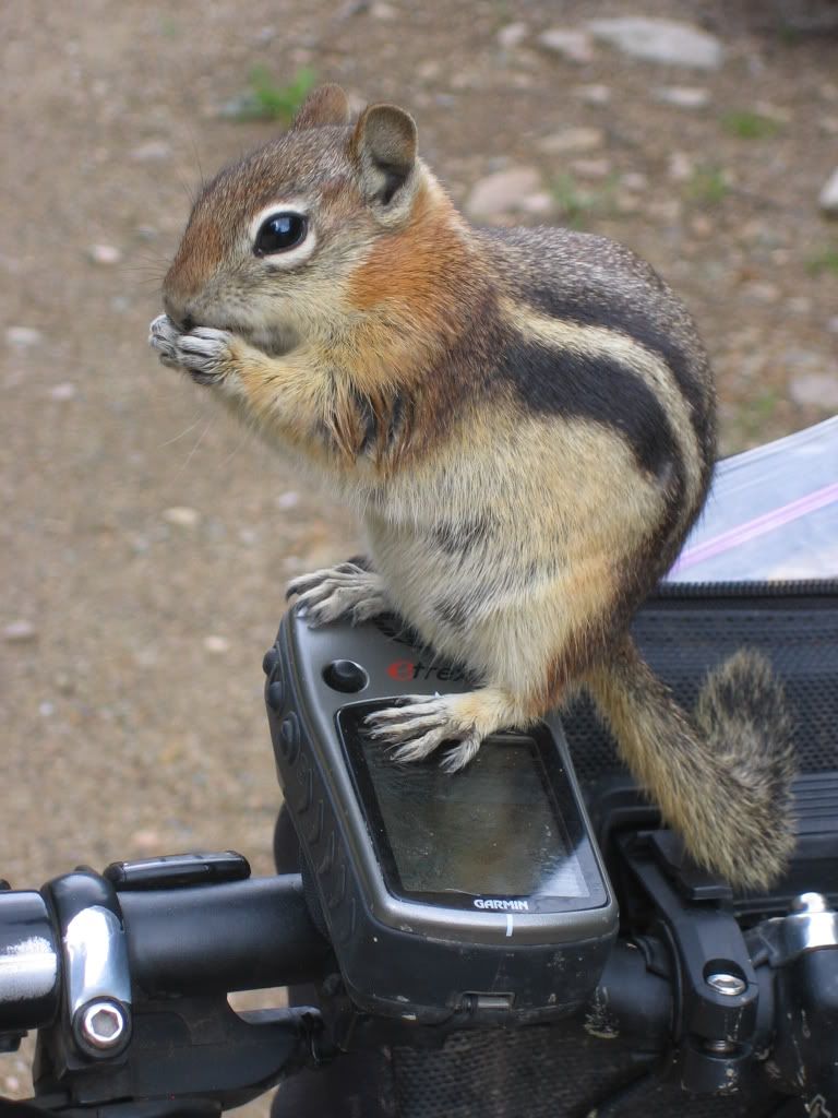
So then it was back to the bottom of Jones Pass to start the next aquaduct trail. As I stopped to refill my water bottle this little chipmunk just about ran up my leg. I turned around and he was sitting on my seat. I scared him a bit but he came back, this time up my front tire. I gave him a piece of dried mango and we talked over lunch.
My little buddy
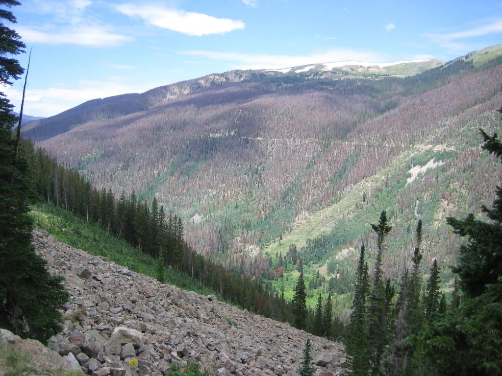
Then he went back into the woods and I went off down the other aquaduct trail. Here's a shot of the second one from the first one. You can really see the devistation the pine beetles have caused in this valley.
Aquaduct
I haven't downloaded the GPS yet so I'm not sure how far I went but I made it all the way past the campground at the confluence of the two Williams Forks (but it was 2,000 ft below me). I ended up riding off the map I had on my GPS and I found an interesting fact: If you ride beyond the GPS map, it disappears completely only leaving your track. I finally reached my turn around time and reversed course. Back up Jones Pass I went. I saw zero people once I was off of Jones Pass...Just the way I like it.
Jones Pass West
Denver has been experiencing a heat wave these last couple of weeks. We're going for a record number of days over 90F (I think we're at 15 now) and we're already on record for the driest year ever up to this point...But on top of Jones Pass below the undercast sky, I needed to put on my jacket because I was starting to get really cold.

Next time I'll be ready to hit the Williams Fork Loop. I really wanted to scope out the aquaduct trails to see if it would be any easier on the Loop to hike up to one of these trails instead of taking the trail that was littered with downed timber the last time I was one it. My conclusion was that the hike-a-bike up to the road wouldn't really save that much time because it was at most 2,000 feet (near the campground) with no trail and lots of downed timber too (due to the beetles). At least I had a nice day of 'alone time'.

Here's the stats:
Distance: 44.8 miles
Total Time: 7:08
Stopped Time: 0:42
Climbing: 6237ft
Profile

Monday, July 21, 2008

Continental Divide Trail

I headed up to Jones Pass on Saturday. I took one of my rc gliders but the wind wasn't good enough so I left it in the car and headed up the pass. The climb over the cornice was interesting but not as challenging as it has been in years past. I was planning on dropping into the valley to check out Bobtail Ck and a little more of the Williams Fork loop but I was just drawn to the CDT snaking it's way down the ridgeline. It was calling to me. I'd never ridden this section of trail but I knew it would be very technical. So I planned on doing it as an out-n-back, but the boy in me continuously asking the question, "What's around the next corner?" kept me going further down the trail. I saw a sign a couple of miles in that said Wood Creek was just a few miles. I thought I could drop down it and hook up with a trail/road that *I thought* connected Woods Gulch to Butler Gulch...Well...There's no trail from the CDT down into Woods Gulch...I had to bushwack back down below treeline before I saw a crushed beer can and I knew I was back near a road. A few minutes later, I found the singletrack that climbs up to Hassell Lake. It was tough...So steep in parts I could barely carry my bike (which, by the way, I did a lot that day). Once up to the lake the trail disappeared. I had been up here before but it was in the wintertime and we skinned back up and over the ridge into Butler Gulch. I knew there was a road that switchbacked up the trail but I was sure where it was. I totally missed it and ended up hiking almost straight up the hillside until I reached the top. Again, I thought there'd be a trail since this little saddle gets skied alot. But once again I was bushwacking back down the hillside to the trail.


Jones Pass 2008

It was definitely a technical day so the stats aren't that impressive (but the views and the difficulty level kinda made up for it)

Distance: 14.24 miles
Elevation: 5100 ft
Total Time: 5:31
Stopped Time: 0:54

Sunday, July 13, 2008

Greys & Torreys Ring Ride

I started off the day on the wrong foot…Didn’t hear the alarm at all (and I had set three times on my watch) so I over-slept and got a late start. It was right after 7am when I started from the visitor’s center in Georgetown (8,500ft) and still a bit chilly compared to the morning temps in Denver.

Up the road and by the RR station to the bike path and then the pungent smell of burning brakes.
Georgetown to Silver Plume Bikepath
That didn’t last that long at least and it was on to the Pavillion Point RR trail. The first part of the trail is two-track but then it turns into this wonderful singletrack that meanders along the railroad grade. It gets tricky in spots where the short trussels are gone or the drainage as eroded back to its former morphology.
Pavillion Point RR grade
It connects at the point to a road that traverses the hillside-with a few ups and downs- to the Argentine Pass road. Argentine Pass is also a railroad grade converted to 4x4 road. It continues at a consistent grade all the way to the abandoned Waldorf Mine (11,600ft).
Waldorf Mine looking up at Argentine Pass
Above the Waldorf, the road gets more difficult to climb. It’s loose and rocky plus the air gets quite thin. I reached the top of Argentine Pass (13,200ft) in just over 3hrs and was greeted by a group of hikers that had come up Argentine from Peru Creek. That was great timing. I wouldn’t have wanted to meet them on the Peru side of Argentine. I didn’t spend much time on top with the group…
Argentine Pass (13,200ft) trail to Peru Ck
This first section is really loose scree but it’s wide and rideable. Just don’t fall to the right…I don’t know when you’d stop tumbling (notice that the camera’s a little tilted towards the rock I’m leaning against—think I’m a little nervous?). The rideability of the descent waxes and wanes. There’s no way I can even picture myself trying to ride all of it. I think there’s always sections I’ll walk.
Argentine Pass
Some sections are nice singletrack and then other sections are boulder fields. There’s even one step that requires lowering the bike first (ensuring that you don’t tip it over because it’ll tumble off the trail), then climbing down the 5’ step.
Last year, there were a couple of large snowfields that I had to kick in some steps but this year there was barely any snow at all—only one 10’ section.
Argentine Pass & Greys
Didn’t take long to get to Peru Creek and the ride down the road was uneventful. When I reached the bottom of Lenawee, I ran into an older guy whom I stopped and talked with for a few minutes. Then this golden retriever showed up and walked with me up the trail. I don’t know whose dog it was but he had this big note on his collar so I figured he was a local just out for a stroll. Up the trail we went.
Lenawee blw treeline
After climbing a bit, I realized that my balance wasn’t quite on…Maybe it’s because I hadn’t ridden much technical trail in a while or I was just having an off day, regardless I just couldn’t seem to clear obstacles that I know I could clear. At one point, I lost forward motion and started rolling backwards, tried to put my foot down on the downhill side only to tumble off the trail over a downed tree and come to rest upside down attached to my bike. I walked a little bit more than I needed to after that. I was really starting to feel the climbing when I rounded the corner into the basin so I stopped for a few minutes. I had set a goal of reaching A-Basin by 6hrs into the ride…It was already at 5hrs and I didn’t think there was a chance. I knew there was still some climbing to do.
Lenawee @ treeline
Once on the traverse, my mood switched around and it started to look like I could indeed make 6hrs so I started pushing a little harder.
Lenawee Basin
Just before the last switchbacks, I ran into biker coming down and we talked for a couple of seconds. I told him where I started from and he gave me a big high-five and seemed more excited about it than I did. It was just the boost I needed to finish off the climb with fortitude and perseverance. My traveling companion turned around and headed home.
My climbing companion on Lenawee
I reached the top right at 6hrs WOOOHOOO!!!
Montezuma Bowl @ A-Basin
Then it was riding the brakes coming down A-Basin. I hit the pavement only to be greeted by mobs of road bikers coming down the pass…I mean MOBS…It was a never ending stream of spandex and flapping jackets that consumed the entire downhill lane, sometimes 3 to 4 abreast. Cars coming downhill were overtaking them on the wrong side of a double yellow line coming straight at me…NOT a good feeling…and the roadies wouldn’t scoot over one bit. At one point, I heard a semi coming up behind me and the downhill lane ahead was full of 2-3 abreast riders. They weren’t going to give him an inch so guess who ended stopping their bike in a ditch until the semi passed? I thought about stopping and getting water at the Snake River above the road but I still had about a quarter of a 100oz bladder and I really didn’t want to stop. I crested Loveland Pass out of the saddle and accelerating. I wanted to get beyond the mob as quickly as possible. I was able to keep up with traffic all the way down the pass. Then it was on to the Loveland-Bakerville trail (which looks like they built it to be a road).
Loveland-Bakerville Trail/Road
Even though it looks lame, after all the climbing done it’s nice to have a long gravel downhill that requires little pedaling and barely a touch on the brakes. It wasn’t long before I reached Bakerville and headed out on the road only to pick up a 3-inch nail. I dinked around with the tire and tube for way too much time. I pinch flatted my replacement tube trying to get the tire back on so now I was down to patches. I really don’t like those self-adhesive patches…They’d hold just enough to get it pumped up and then blow out…But I finally got one to hold long enough to get back to the car. I knew I should’ve done the chamois cream on the bead from the start but I was lazy and didn’t think I needed to…lesson learned.

In the end, I was way ahead of last year’s time until the flat. But I still managed to better my time by 5 minutes.

Here’s the stats:
Distance: 45.6 miles
Climbing: 8919 feet
Total Time: 8:11
Stopped Time: 1:09 (40 minutes for that stupid flat)
20080712

Wednesday, July 9, 2008

The Black Hills Tour - Part 2

Day 2
The second day started at the southern campground at Sheridan Lake. The first segment of the Centennial Trail was the Samelius section that connects Sheridan Lake with Hwy 16A via a steep and rocky ascent and descent. I started up the climb expecting my legs to begin to complain from the previous day’s ride but they seem ready and willing to tackle the task at hand.
Rough riding on Samelius
Near the top, you get a good view into Hill City so I thought I’d try the cell phone. Yep coverage here:
View from Samelias Ridge
Somehow on the descent down the jeep road, I missed the turn off for the last segment of singletrack. Darn! I really like that section, so much so, that I *almost* went back up to find it. Instead, I pushed on through the rolling hills and meadows between 16A and the railroad tracks. Next was the steep climb up to the Big Pine trailhead. I remember coming down this section on my first Centennial Trail excursion but I’d never been up it. I’d have to say that 95% was not rideable (by my standards). It was so eroded, loose, and steep that I’d have to say I didn’t even try to ride much because I knew it was a fruitless endeavor. From reading the tracks left by previous hikers, I was thankful that I didn’t have to slip, slide, and struggle through the mud like they did. Once at the trailhead, I sat down, ate some food, and waited for Misty. I had debated riding the road through Needles Hwy but I decided not to although I was feeling fine. It turned out for the better because on our drive to the Iron Creek trailhead, we encountered golf ball size hail. The first one hit the windshield in front of Misty with such force that we thought it was coming through (or at least cracking the glass) but neither occurred. The intensity of the storm heightened so I pulled off the road and tried to get my sister’s van under a tree to protect as best I could. The hailstones were ripping right through forest canopy and bouncing 2-4 feet in the air after impact.

I could only image how this storm would feel if I had been cruising on the bike down this section of the Needles Hwy. That first hit would have been so much of a shock that I sure I would’ve thought someone threw a rock at me. After looking at the dents on the van, I’m sure the hailstones would’ve left bruises.

I waited for the hail to pass before starting off down the trail. I was excited and anxious to ride the southern parts of the Centennial since this would only be my second time on the trail and my first time riding south. I remembered small portions of the trail but much of it was still a blur. My anxiousness stemmed from the encounters with buffalo I had the first time I rode this section. They are so big, seemingly intelligent, and unpredictable…You never know when you’ll come around a corner and be face-to-face with these giants so you’ve got to keep on your toes.

The GPS actually got used for navigation within a few miles of the trailhead. Somehow I had missed a turn, evident only be the absence of “89” trail markers. I had to derive the track on the GPS for the entire southern section of the trail using only waypoints I had created on my first ride, aerial photography, and topo maps. My old GPS had very limited capabilities when it came to saving tracks (in fact all I had of a track from that first ride was from Elk Ck to Bear Butte) so I compensated by trying to save lots of waypoints. It didn’t take me more than a few minutes to find my error in navigation and I was back on track.

Remnants of the hailstorm quickly disappeared but that only meant more puddles and more flowing water on the trail. There’s one segment just south of Legion Lake that has great flow, good views, but it was over way too soon…And now it looks like another storm is approaching.
Storm a-comin by Mt Coolidge
There was only one segment of the Centennial through Custer State Park that really stood out in my mind…the climb into and out of French Creek. There is what looks like a minor pass on the map just north of French Creek that should not be disregarded because of its small stature. This year I realized that approaching this pass from either direction involves a fair bit of hike-a-bike. The trail was a poorly designed, fall-line trail with no water bars or breaks. Erosion had converted this presumably once nice trail into a never-ending series of loose rock and gullies. I was happy to reach the top and be able to look down into French Creek gulch. But the darkening overcast skies and rumble of distant thunder shortened my break.
Top of French Creek Pass (Hike-a-Bike Up, Hike-a-Bike Down)
I started off trying to ride this trail down but after almost losing it over the bars more than once (the last time while trying to stop and dismount) I decided it was best to just walk it (although that option brought on other concerns of twisting an ankle). About a third of the way down, sections were rideable again with occasional sections that needed to be walked. I was really looking forward to cruising up the old jeep road that follows along French Creek to the horse camp, however, the mental image of an easy spin up a road gave way to the harsh reality of a road overused by horses during a muddy period. When it wasn’t full of hoof potholes, it was loose sand. On top of that, French Creek was thigh deep and there were at least a handful of crossings. I did happen to run across this prairie rattler.
Prairie Rattlesnake on the French Creek Trail
The road climbing out of the French Creek horse camp was no better. I guess it doesn’t matter by whom a trail is overused…Overuse = poor trail conditions.
Horse Divets outside French Creek Camp
By this time, the threat of a serious thunderstorm was eminent. The thunder was rumbling ever closer but I knew I wanted to try and get well clear of the overused section of trail before the rains came so I continued to push on. Hailstones arrived shortly thereafter but they were small and sparse when the storm started so I continued to push my bike up a short, steep hill. By the time I got to the top, the hail was coming down in sheets so I tried to take cover near a rock outcropping but it didn’t seem to help. The waterproofing job I had completed at home on my backpack proved to be a waste of time. No beading at all, it was soaking through. I quickly dug out my jacket and put it on to lessen the sting of the hailstones. As I sat with my eyes closed, knees tucked into my chest, and tense from the beating, I began to take control of my situation in best way I could. I created a soothing mental image of being a subject of some ‘new-age’ massage therapy where they implemented a shower of hailstones for deep muscle massage. Even to my surprise, this mental exercise seemed to work by relaxing my muscles and helping me happily accept these circumstances.
Hail Storm Massage
Once the hail stopped, I got back on the bike and headed down the trail. I went to put on my glasses but the advantage of wearing them to keep the mud and water out of my eyes was trumped by their fogginess. The sound of hail crunching under the tires was odd but interesting and not as slippery as I would have expected. The sun peeked out from behind the clouds within a half-hour as I entered onto a large, open ridge. The incident afternoon sunlight on the grasses induced a surreal experience while splashing through this open area. An encounter with a turkey heightened this feeling even more.
The Good
But just like a drug-induced euphoria is followed by a crash, the sunlight I had welcomed just a few brief minutes before had almost instantaneously transformed the hailstones into torrents emanating from every small drainage. The trail had become a river of mud that I knew masked gullies and debris below its surface. I had no choice but to choose a route off the trail where the water was only ankle deep.
The Ugly
I pushed on down the trail (or at least right next to it) only to encounter a buffalo around a downhill corner that was guarding his wallow. I chose not to ride by him, rather, I chose to walk right along the edge of this open area to at least give me a false impression that I could climb a tree (or hide behind them) if he decided to charge.
His Wallow
The landscape through this portion of Custer State Park had changed since my visit a couple of years ago. Fires had swept through the area and it looked nothing like I had remembered. The GPS reminded me that I was nearing the end of the trail and I knew of one more prominent landmark that I had yet to cross. It is a large meadow where I encountered my first buffalo a couple of years ago. That experience was somewhat unnerving because there is an 8-foot fence and a gate on the south side of the meadow that I needed to get through but the buffalo wanted to go through too. As he walked towards me smelling the air to sense me, I dropped the bike, ran up the hillside, and climbed the fence until he passed. This time, it was ironic that a buffalo was standing in almost the exact same spot. But once he was aware of my presence, he bolted at a gallop up the hillside and into the trees. I’d never seen a buffalo move so fast.

By now, the results of the hailstorm had turned the trail to a slippery gumbo that was beginning to build up on the bike. I knew I only had a few miles left so I struggled through the best I could hoping not to break anything when I came across a herd of elk.
Elk Herd on the Run
Less than a mile to go now but the bike was starting to make crunching sounds that usually precede some kind of mechanical failure. I hobbled my steed to the end of the trail and promptly stopped in the creek to clean as much of the mud off as I could.

I looked at my time…Almost exactly 36hrs.

Since Misty and Aspen weren’t at the trailhead, I took the dirt road heading southeast across the prairie mesa towards Red Valley at a leisurely pace. Just before dropping into the valley, I took out the cell phone and gave Misty a ring. They were in Hot Springs and we planned to meet at the end of Red Valley Road. The jubilance of finishing the trail swept over me as I coasted down the desolate dirt road, out of Wind Cave National Park, and away from the next impending storm…which, by the way, dropped another massive amount of hail.
Resting through Red Valley

Thursday, July 3, 2008

The Black Hills Tour - Part 1

The Black Hills Tour…I’ve been thinking about this ride for over a year now. There are two long trails (>100miles) that traverse the Black Hills north to south. They are the Centennial Trail and the Mickelson Trail. Both have unique character but in completely different ways.

The Centennial Trail starts out in the prairie outside of Sturgis at Bear Butte, continues on through the central rocky area near Mt. Rushmore, and ends at the southern prairies of Wind Cave National Park near Hot Springs for a total of around 114 miles. It is mostly a hiking trail but it utilizes jeep roads throughout the Hills. There are two sections that cannot be completed by bike. The first is the Black Elk Wilderness area near Mount Rushmore and the second is the last few miles within Wind Cave National Park. As far as I know, the record time for completing the Centennial Trail is 21 hours but that should either be omitted or caveated because the rider ‘poached’ the Wilderness area.

The Mickelson Trail starts in Edgemont and ends in Deadwood for a total of 109miles. This trail is a rail-to-trail conversion and passes through Custer and Hill City with maximum grades of about 5%.

I spent a lot of time up in the Black Hills for work around 2000 and I got to know the trails and all the back roads pretty well. I used to do sections of the Centennial and Mickelson but it wasn’t until 2006 that I attempted to ride the entire Centennial Trail. That was my first multi-day ride and I completed with the support of my wife and daughter. They would meet me along the way at the various trailheads, feed me, and refill my water bottles, etc. It took me 36 hours going south to north (and I portaged around the wilderness area in the car) but I was completely spent after both days to the point that I could barely eat even after hours of being off the bike.

Last year, Marshal and I attempted the Black Hills Tour in late-July, but the record high temps in the mid-100s were too much to cope with. Marshal called it quits about 30 miles into the Centennial and I left the trail after about 75 miles (~36hours). The heat just sapped the energy out of you and I couldn’t keep up with my intake of water and electrolytes.

This year I was back doing it solo. I would have limited support from my family again, but I felt more confident that I could travel more trail without support than I did in 2006. My sister let us borrow their van for the trip which was more than considerate of her. I had plans of camping at Bear Butte and getting a pre-dawn start, but when we arrived in Lead, my friend had cleaned his house and offered us his bed…How could I refuse? So I opted to stay at his house and then get a dawn start the next day instead. He had a telescope so we set it up and checked out the rings of Saturn before we called it a night.

Day 1
We packed up and left Tony’s house around 4am. By 5am we were at the campground in Bear Butte State Park. There was plenty of light to see by so I didn’t need a light and I started off across the earthen dam just before the sun peaked over Bear Butte.
Bear Butte Sunrise
Leading up to this day, I was mostly concerned about how I was going to cross the first creek (Bear Butte Creek) near Sturgis. I really didn’t want to start the day off with wet feet so I was playing the scenarios over and over in my mind: Do I take off my shoes and socks to wade through or do I deal with wet feet? After the first mile of riding through the dew laden prairie grasses, my dilemma was mute…my feet were soaked and I hadn’t crossed ANY creeks. All of the rain that they have been getting was evident in the green hue and thickness of the prairie. In some places along the Bear Butte bluffs, the grasses were hitting my handlebars.
Bear Butte Bluffs
I picked up my first tick just before getting into Fort Meade. I caught him before he had burrowed in so I didn’t have to dig the head out. In Fort Meade, evidence of torrential rainfall caught me off guard as I was able to make a quick dismount over the bars when the trail dropped off into a deep erosion gulley. As I rode on, the evidence became more pronounced. I stopped at the cemetery to take a quick picture from outside the gate.
Ghost at Fort Meade Cemetary
I think the aberration may be a ghost…I didn’t feel a presence, but my MP3 player skipped at that moment. The next flood-induced obstacle was the new underpass at I-90. In years past, you could just ride right into the underpass and through it, but this year they constructed a new underpass and they didn’t amour the downstream side adequately resulting in a 6-8 foot drop that made even climbing in from the streambed impossible. My solution was to drop into it from the side which resulted in about a 4-6 foot drop. Directly upstream of the underpass is this trestle:
Alkali Creek Trussel
The climb up Bulldog Hill was everything I remembered. My new back tire really started to show it’s benefit on the loose parts of this climb.
Bulldog Hill
It wasn’t until the descent off Bulldog that I was again caught off guard by the erosion gullies which again resulted in a quick dismount over the bars. However, this time I ripped the rear derailleur cable from its clasp. I quickly fixed it and was again on my way up the climb to reach Elk Creek. There’s usually a dry creek that is crossed a few times on this section and I was surprised to see that it actually had flowing water.

The Elk Creek trailhead was just like I remembered and I was anticipating the steep, rocky descent to the creek where Marshal and I had taken an extended break last time to fill up our water and soak in the cool waters during the heat of the day. As I rounded the corner to the descent, there were a couple of logs across the trail that took me off the bike. Hmmm. Sure enough they re-routed this section but because of all the rain, the new trail was not evident, in fact, it looked like it never existed.
Elk Creek Re-route
The re-route was a more mellow approach to the creek, but the roar of the creek told me it wasn’t going to be like last year. Elk Creek was more swollen than I had ever seen it before. Although it was running clear, the swiftness of the torrent made me question whether it was passable. It was moving so fast and looked so deep that I was concerned about all my electronics so I took my MP3 player and camera and put them into the top of my pack before attempting a crossing. That first crossing was nearly mid-thigh deep and swift enough to force me to angle the bike with the current to keep it from either being ripped out of my hands or having it run into me taking my feet out in the process. The thrill of crossing the creek without going down put me in an ebullient mood. Even the downed trees crossing the trail couldn’t extinguish the feeling of joy. With each creek crossing the joyfulness of being in the situation continued to grow.
Elk Creek knee deep
The climb out of Elk Creek was riddled with downed trees slowing my progress much more than I had expected. Eventually I neared the rim of the canyon and soaked in the view before moving on.
Elk Creek Bend
I don’t think I will ever be able to complete the remainder of the climb without thinking of the tribulations that Marshal and I had last year on this climb. Last year, we climbed this section in the middle of the day when it was 106F. We struggled but we eventually made it to the top. This year was completely different, it was still mid-morning with mild temps and it didn’t seem to be nearly the obstacle that it was last year. Upon reaching the top, I called my wife to let her know of my progress and we planned to meet in Nemo for lunch. As soon as I reached the road that used to be the end of the singletrack, I found that they have re-routed the trail directly across the road. I don’t know if the re-route was there last year or not. I was too concerned about getting to Dalton Lake to even look for it. But this year, it was right across the road clear as day.
New Descent to Dalton Lake
It is a great edition and continuation of the singletrack coming out of Elk Creek. It follows along the ridge for a few miles before dropping down to Dalton Lake. I relished every new foot of singletrack soaking in the new terrain and trail. The only problem was that it is slower than the old route which put me behind my time schedule and I was going to really have to push it to get to Nemo by the time I told Misty. I ran into the first person on the trail since starting right at Dalton Lake.

The next section of trail is where ATV traffic begins. Upon the first mud hole, I realized that all the ATV traffic did not bode well for me through this segment. There were mud holes, and slippery rock everywhere which just put me that much further behind when I told Misty I’d meet her. However, I took my time through this rough and rocky section because I knew that pushing it at this time would only end in disaster. I skipped the section of the trail that circumvents Nemo because I was already late and I knew that it would be just as bad, if not worse, than the section I just came through. We sat down and ate lunch (which took over an hour) and I was back on my way. We discussed where to camp for the night and I thought that the southern end of Sheridan Lake would be a good spot. I knew that getting a record time on the Centennial was out of the question considering the trail conditions to this point and that would still put me about 60-70 miles into the ride. Box Elder Creek TH to Pilot Knob was a series of mud bogs. Some I could navigate around but most I just had to walk through and hope I didn’t lose a shoe.

While the section from Bear Butte to Dalton Lake was very overgrown in some areas needed more trail use to keep a good base, Dalton Lake to Pilot Knob showed serious signs of overuse.
Box Elder Mud Bogs

After Pilot Knob, the trail returned to singletrack and the undulating trail through the forest under overcast skies with slight sprinkles required very little effort to travel down. Mostly downhill, this section was covered quickly and before I knew it I was meeting with Misty and Aspen, cleaning the mud from my shoes and socks in Rapid Creek. The climb up Tamarack Gulch was uneventful but the solitude of a rarely used trail was welcomed.
Green Grass Up Tamarack Gulch
The Bald Hills past the Brush Creek TH were more green than I had ever seen them. Last year, I had to stop and rest before pushing through the Bald Hills because I knew that there would be no shade on the climb because sun+heat made these otherwise beautiful hills formidable. This year, I had an overcast sky which tamed the climb.
The Bald Hills of the Black Hills
Crossing Sheridan Lake dam marked the end of the day. I pulled into camp right at sundown.
Southside of Sheridan Lake